At Geo2X, we thrive on new challenges. A brief chat is often the most effective way to explore how our services can benefit you. Don't hesitate to reach out!
At Geo2X, we thrive on new challenges. A brief chat is often the most effective way to explore how our services can benefit you. Don't hesitate to reach out!
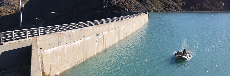
A conventional echo sounder transmits an acoustic signal towards the bottom of the water and analyzes the echo. Knowing the speed at which acoustic waves propagate through the water, as well as the time between signal emission and echo reception, it is possible to determine the distance between the sounder and the seabed.
Multibeam bathymetry uses several sensors simultaneously to cover a wide area of the seabed, while enabling continuous data acquisition.
These systems are mounted under the boat's hull. A multibeam echosounder is an ideal system for monitoring and inspecting the lake or seabed. It offers excellent resolution (10 points/m2) and accuracy (3-5cm). It can operate at depths of 1 meter or more.
In addition, our drone based solution allow aquisition in areas difficult for a boat to reach.


